
 Contatto
 Come acquistare
Consegna
Guida all'acquisto
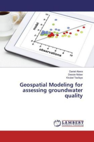
Geospatial Modeling for assessing groundwater quality
 Inglese
 103 b
103 b
Fino a 30 giorni per il reso
I clienti hanno acquistato anche



 /
/
 In brossura
 164.49
€
164.49
€








 /
Rigido
7.29
€
/
Rigido
7.29
€














 /
In brossura
14.19
€
/
In brossura
14.19
€




Geospatial modeling and mapping has become an important tool for investigating and managing natural resources at the landscape scale. Exhaustive studies are expensive and time consuming, so the phenomenon is usually characterized by taking samples at different locations. Geostatistics is then used to produce predictions (and related measures of uncertainty of the predictions) for the unmeasured locations. Topics covered in this book include: An overview of the Geostatistical method (Kriging), How to describe and model spatial patterns (Variography), Exploratory Spatial Data analysis-(ESDA), Structural Data Analysis-(Ordinary Kriging), Isotropy and Anisotropy for identifying and adjusting directional influence, Semivariogram Model Selection, Model Validation and Surface Generation, Indicator Kriging for risk assessment: given the spatial data set. The book explores how to extract information from both Geographic Information System and Global Positioning System, and how to combine this with groundwater field data to produce a spatial model that can be reconstructed and displayed using arc GIS software. Readers learn the requirements and steps towards geostatsitical model and maps.


Informazioni sul libro
Inglese
Categorie

Regala questo libro oggi stesso
È facile
1 Aggiungi il libro al carrello e scegli la consegna come regalo 2 Ti invieremo subito il buono 3 Il libro arriverà all'indirizzo del destinatarioPotrebbe interessarti anche
 /
In brossura
46.59
€
/
In brossura
46.59
€
 /
Rigido
42.59
€
/
Rigido
42.59
€


 /
In brossura
33.69
€
/
In brossura
33.69
€

 /
In brossura
28.09
€
/
In brossura
28.09
€


 /
In brossura
15.39
€
/
In brossura
15.39
€


 /
In brossura
21.09
€
/
In brossura
21.09
€

 /
In brossura
10.69
€
/
In brossura
10.69
€
 /
Rigido
57.29
€
/
Rigido
57.29
€




 /
Rigido
62.89
€
/
Rigido
62.89
€
Ciao! Sono Libroamiko, il tuo consulente di libri.
Come posso aiutarti?