 Contatto
 Come acquistare
Consegna
Guida all'acquisto
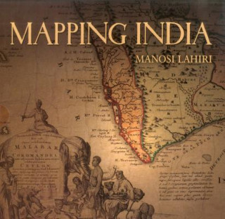
Mapping India
 Inglese
 321 b
321 b
Fino a 30 giorni per il reso
I clienti hanno acquistato anche


It began five hundred years ago when the very first modern maps of India were drafted. Travellers, wanderers, explorers and traders came overland from the West and carried back tales about the India of their perception. The first maps of India were drawn based on the accounts of these men. When the sea route to India opened, sailors ferried back information about the ports they touched on their way to India. Marine charts of the routes along the ocean coasts and artistic representations of port cities followed. As Europeans came in large numbers to trade and conquer, new territories further inland were mapped. The British surveyed and mapped India under their rule to settle borders, calculate tributes, assess taxes and record defence positions. At the end of the colonial period, once again maps identified the boundary between the new nations of India and Pakistan on maps of the sub-continent. "Mapping India" presents an overview of important maps that eloquently reflect the changing social and political fortunes of India. These maps speak of the commercial interests and wars that led to the colonisation of India, and show territories the size of countries that were conquered, ceded or controlled through treaties. They also record changed courses of rivers, routes taken by armies, people living in communities in new cities, places where famines occurred, how the highest peak was discovered and named, when native royalty gathered to pay respect to the British Emperor, and the destination to which Mahatma Gandhi marched with his supporters for the salt satyagraha. From the earliest chronicles of India to its post-Independence strides, "Mapping India" is the story of India recounted through its maps.


Informazioni sul libro
Inglese

Regala questo libro oggi stesso
È facile
1 Aggiungi il libro al carrello e scegli la consegna come regalo 2 Ti invieremo subito il buono 3 Il libro arriverà all'indirizzo del destinatarioPotrebbe interessarti anche


 /
/
 In brossura
 18.19
€
/
In brossura
42.49
€
18.19
€
/
In brossura
42.49
€
 /
In brossura
27.89
€
/
In brossura
27.89
€

Ciao! Sono Libroamiko, il tuo consulente di libri.
Come posso aiutarti?