 Contatto
 Come acquistare
Consegna
Guida all'acquisto
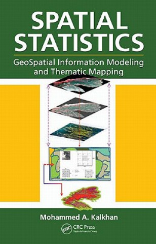
Spatial Statistics
 Inglese
 371 b
371 b
30 giorni per il reso
I clienti hanno acquistato anche


Geospatial information modeling and mapping has become an important tool for the investigation and management of natural resources at the landscape scale. Geostatistics reviews the types and applications of geospatial information data, such as remote sensing, GIS and GPS, as well as their integration into landscape scale geospatial statistical models and maps. Readers will learn the requirements and limitations of each geospatial tool. With statistical data analysis methods, the text includes laboratory exercises using ArcInfo, ArcGIS, ArcView, and other popular software for geospatial modeling. It also features case studies with examples.


Informazioni sul libro
Inglese

Regala questo libro oggi stesso
È facile
1 Aggiungi il libro al carrello e scegli la consegna come regalo 2 Ti invieremo subito il buono 3 Il libro arriverà all'indirizzo del destinatarioPotrebbe interessarti anche

 /
/
 In brossura
 16.39
€
16.39
€

Ciao! Sono Libroamiko, il tuo consulente di libri.
Come posso aiutarti?