
 Contatto
 Come acquistare
Consegna
Guida all'acquisto
 Inglese
 60 b
60 b
Fino a 30 giorni per il reso
I clienti hanno acquistato anche
 /
/
 In brossura
 16.09
€
16.09
€





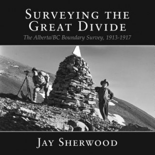
In 1917, during Canadas 50th anniversary, there was little celebration in the country as it entered the fourth year of World War I. This conflict had a tremendous economic and emotional impact on the various levels of government in the country and on the lives of many people in Canada. In western Canada, despite the turmoil and uncertain outcome of the war, one of the countrys major surveying projects continued. In 1913 the Alberta, British Columbia, and Dominion governments began surveying and marking the boundary between the two provinces along the Rocky Mountains. British Columbias representative, A O Wheeler, scaled many of the peaks along the Great Divide and did the phototopographic surveying. R W Cautley, the representative for the Alberta and Dominion governments, mapped the boundary through the economically important mountain passes. During the years of 1913-1917, the Boundary Commission surveyors mainly covered the area from Kicking Horse Pass to the United States border.


Informazioni sul libro
Inglese

Regala questo libro oggi stesso
È facile
1 Aggiungi il libro al carrello e scegli la consegna come regalo 2 Ti invieremo subito il buono 3 Il libro arriverà all'indirizzo del destinatarioPotrebbe interessarti anche

 /
In brossura
18.69
€
/
In brossura
18.69
€



 /
In brossura
44.79
€
/
In brossura
44.79
€
Ciao! Sono Libroamiko, il tuo consulente di libri.
Come posso aiutarti?